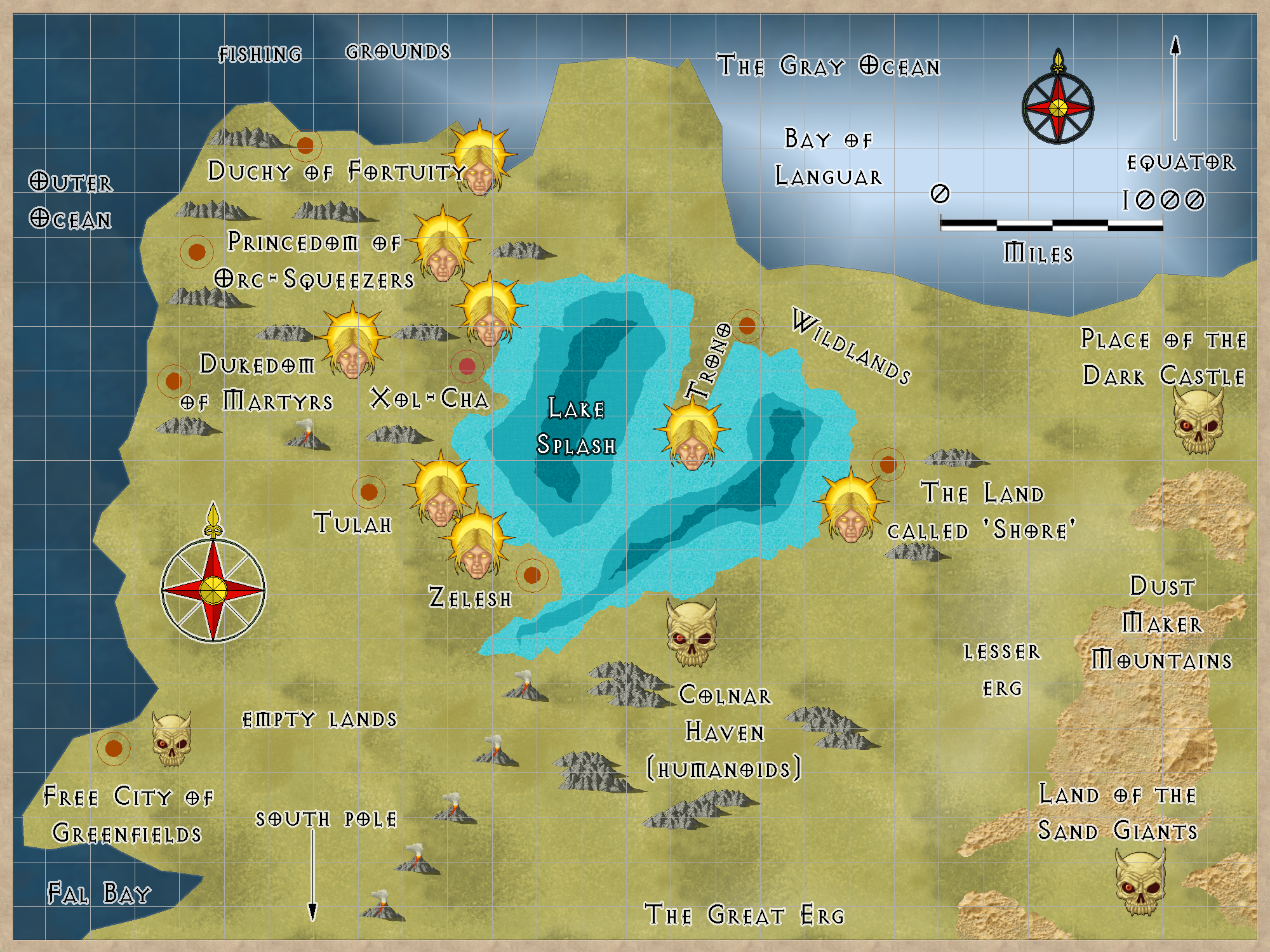
About the middle of the Southern Continent, Bellshar. It is part of The Gray Ocean.
The water is a strange off-gray color.
"Welcome to Crest of a Star; these maps and other graphics are only for playing D&D type games. They are copyright and not to be used for other purposes. If you have them on your site, please remove them. Thank you."
Hi and welcome to my Crest of a Star site ! This site is my first edition AD&D materials.
I have added to the maps, people, etc. since I bought Campaign Cartographer 2 around 23 or so years ago. I now have CC3+ and all of its add-ons.
Link in the Home text at the top of this drop down will bring you back to the front page of this site.
My other rpg sites below.
Posted
About the middle of the Southern Continent, Bellshar. It is part of The Gray Ocean.
The water is a strange off-gray color.
Author
Bill George
Categories
Gray Ocean
Posted
Author
Bill George
Categories
South Hemisphere
Posted
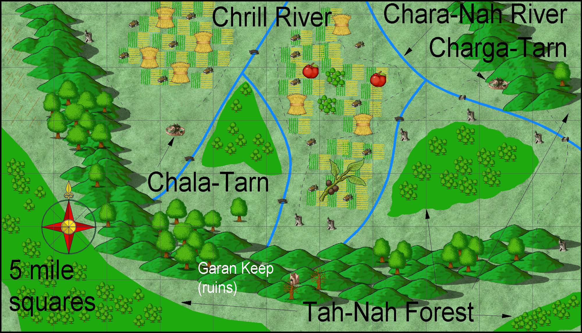
map of Chaga-Tarn and Chala-Tarn
Chrina is the capital and sea/fishing port
harbour, a small fishing school with a lake to teach fishing techniques to youngsters before they go out on the ocean. And open air market for trade between sea captains and the inland farmers and others.
Charga-Tarn Geography and resources
Chaga-Tarn is mostly a farming community. There are a few buildings where fishing fleet people stay while learning to fish in the local streams.
Chala-Tarn Geography and resources
Chala-Tarn is mostly a farming community. There are a few buildings where fishing fleet people stay while learning to fish in the local streams.
Author Bill George
Posted
The island government is run by the farmers and the sea captains.
Equal votes in each group. Since they realize to argue over much is to fail and doom their peoples, they tend to agree more often than not.
Author
Bill George
Categories
Outer Ocean
Posted
upped in size from 1200 pixels to 2000 pixels
Chala-Tarn and Charga-Tarn area:
Garan Keep is one of the very few ruins on this island.
Author
Bill George
Categories
Outer Ocean