"Welcome to Crest of a Star; these maps and other graphics are only for playing D&D type games. They are copyright and not to be used for other purposes. If you have them on your site, please remove them. Thank you."

"My maps are free. If you purchased them, you got scammed."
"Not for redistribution or resale. Hyperlinking from Pinterest or other such share sites is prohibited."


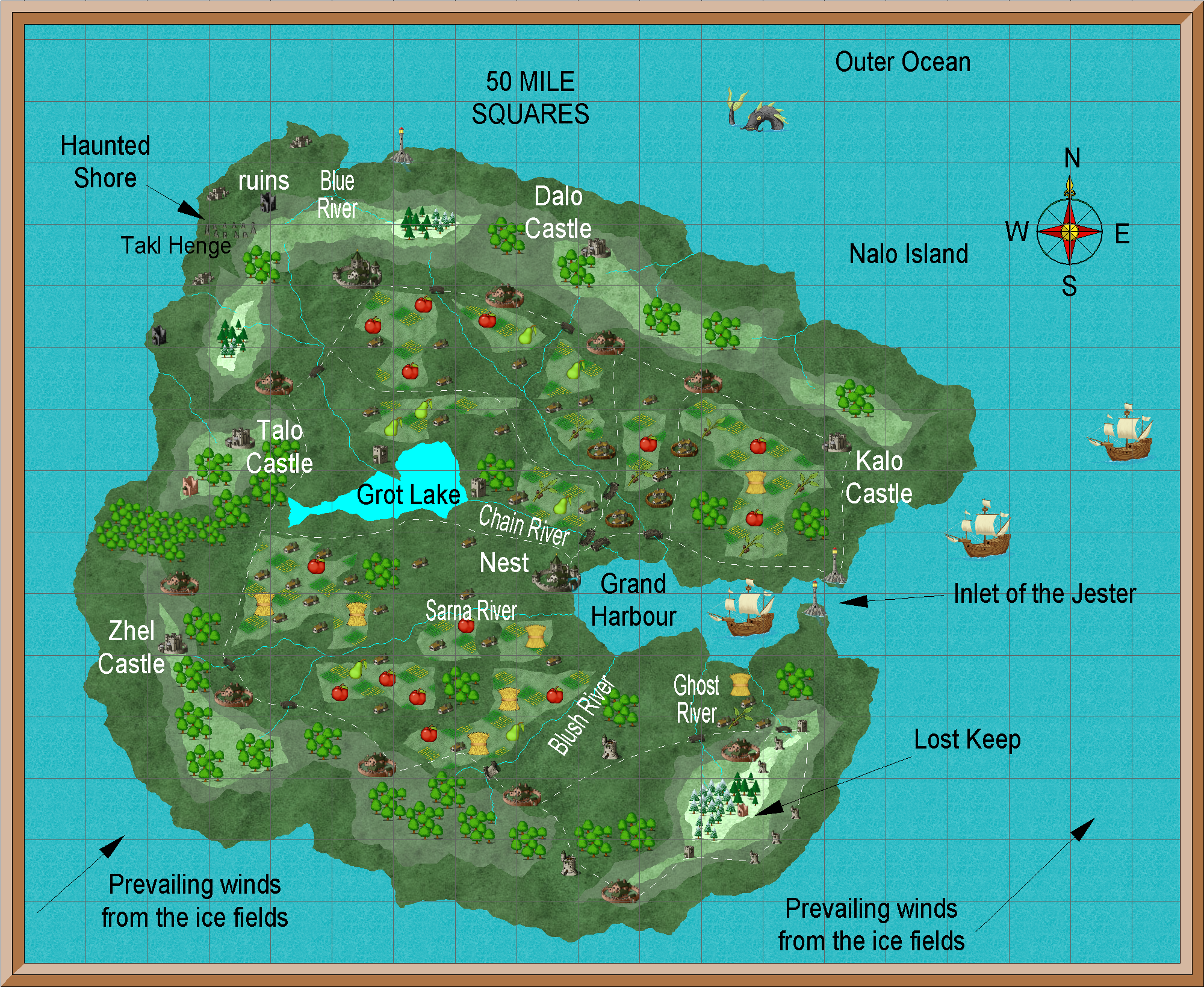
Nalo Island, Southern Hemisphere entrance page

Posted

A parlimentary monarchy that is allied with Trillolara. They are considered to be mighty sea traders. Most Trillolarans refer to this island as the Isle of The Jester because their coins have a jester’s face on one side. (Alignments: NG, CG) Its located in the Outer Ocean east of Dank Forest. LG, LN, CN, and N alignments are tolerated, or allowed, here.

Ages and immigration waves history page | Tar-Nalo history


A little over one million square miles in area.

Imports: Beef and a few horses

Exports: fish, apples, pears, a specialty wheat, olives, olive oil

Has several unexplored adventuring areas.

Author


Privacy policy: I track IP addresses and pages looked at out of a vague curiosity to learn what pages are looked at on my site. After a set period, this information is deleted. No personal information is permanently kept.


[ Copyright © by Jim, 1980-2050. All Rights Reserved. ]

[ Except where noted, and where copyrights are held by others. ]